AGDM provides full-service dredging and marine construction capabilities for federal, state, and municipal clients. From hydraulic cutterhead operations moving 120,000 cubic yards to precision mechanical excavation in sensitive environments, we bring the right equipment, the right expertise, and the right approach to every project.
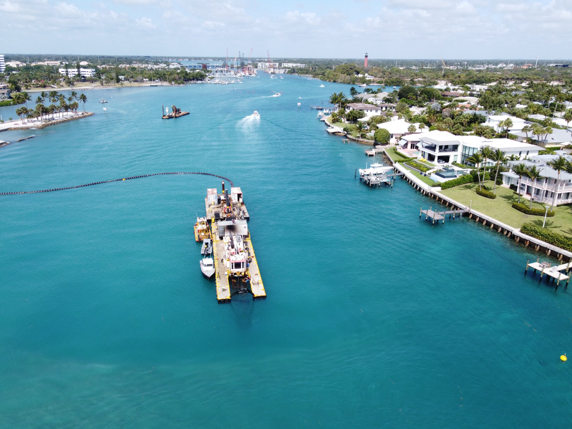
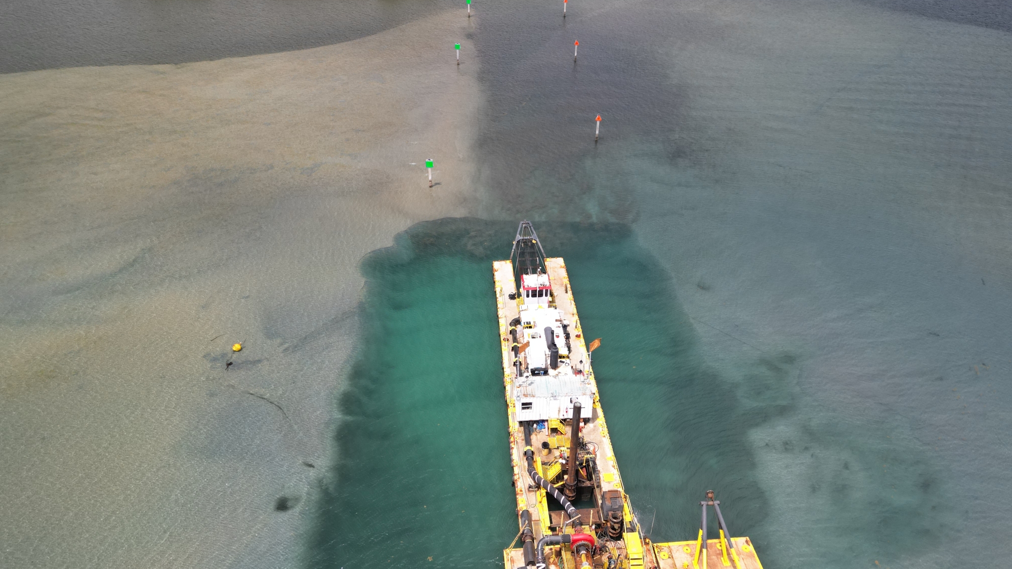
Our flagship capability. AGDM operates a 16-inch hydraulic cutter suction dredge — the "Commodore" — purpose-built for sand trap maintenance, navigation channel dredging, and beach nourishment operations. We run 24-hour continuous operations with computerized dredge positioning to maximize production while maintaining precision grade control.
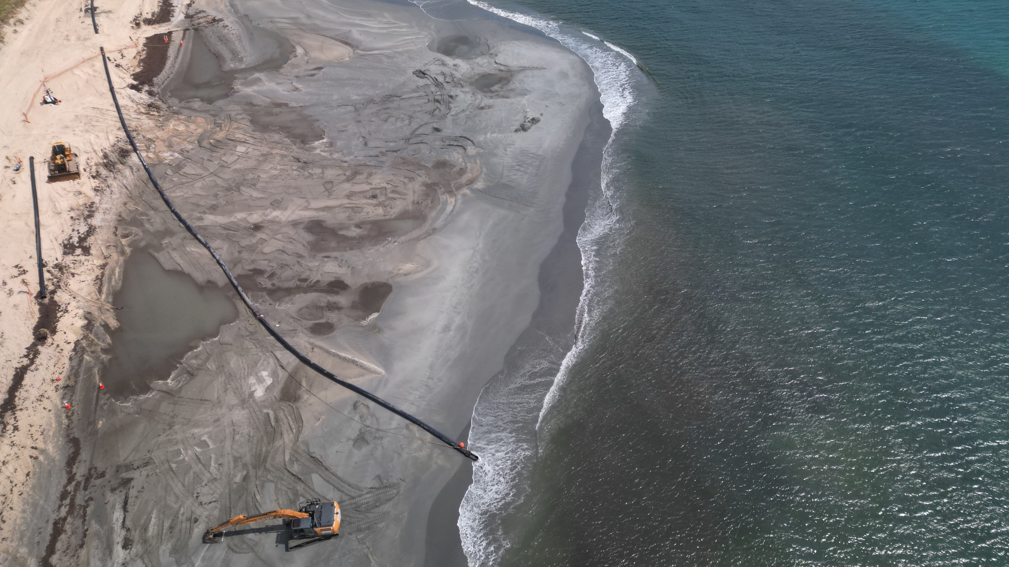
Our cutterhead operations are backed by booster pumps and extensive pipeline systems — submerged, floating, and shore configurations — enabling long-distance pumping to beach placement sites.
AGDM maintains full mechanical dredging capabilities including clamshell, swinging ladder, and excavator-based operations. Mechanical dredging is deployed for canal muck removal, confined waterway excavation, and projects where material characteristics or site constraints favor mechanical methods over hydraulic.
Our mechanical fleet includes long-reach excavators, dozers, and barge-mounted equipment capable of handling a wide range of material types from organic muck to compacted sand and rock.
AGDM has delivered multi-million-dollar beach renourishment projects for Florida's most critical coastal protection programs. We dredge sand from inlet sand traps, navigation channels, and impoundment basins and place beach-compatible material along eroded shorelines for storm damage reduction and habitat restoration.
Our beach nourishment work includes full pipeline installation, beach profile contouring, and coordination with sea turtle nesting season restrictions and environmental permit conditions.
In-house hydrographic and land surveying provides real-time production tracking, pre- and post-dredge condition surveys, and precise volume calculations. All survey data is processed and plotted using AutoCAD for accurate CQC production reporting and regulatory submissions.
Our computerized dredge positioning systems provide operators with intuitive interfaces showing real-time cut lines, grades, and proximity to sensitive habitats — eliminating guesswork and protecting resources like seagrass beds.
Environmental stewardship is built into every AGDM operation. We perform continuous water quality monitoring including pH, Dissolved Oxygen, Turbidity, Copper, Lead, and Arsenic testing throughout all dredging activities. Our team is certified for USACE, FDEP, and county-level environmental reporting protocols.
Manatee observation programs, seagrass impact avoidance, turbidity barrier deployment, and real-time environmental data collection ensure our projects meet or exceed all permit conditions.
Every cubic yard we move is tracked in real time. AGDM deploys integrated Trimble GNSS and Hypack navigation systems across all dredging operations — providing centimeter-level positioning accuracy, live cut-depth monitoring, and full digital documentation from mobilization to final survey.
Our positioning infrastructure enables precise compliance with environmental setback requirements, authorized project depths, and zero-tolerance overdredge specifications — critical for work in seagrass-sensitive and environmentally monitored waterways.
Sand Trap & Channel Maintenance
Nourishment & Coastal Restoration
Intracoastal Waterway Dredging
Muck Removal & Grading
Navigation & Basin Dredging
Maintenance & Restoration
Underwater Placement
Storm Damage Reduction